On Monday, the first day of the workshop, we will meet in front of the Faculty of Architecture. You will receive the room number where the workshop will take place. All work is done by hand drawings, and our team provides all necessary materials. It is highly recommended that you read the suggested readings before starting the course:
Contemporary Public Space: Critique and Classification, Part One: Critique Matthew Carmona, 2010
Contemporary Public Space, Part Two: Classification Matthew Carmona, 2010
Until the beginning of the 20th century, the city's public space consisted of streets, squares and parks. With the advent of modernism, this list was expanded to include green open spaces between solitary buildings. After 1990, with the new economic model of urban development, the nature of public spaces in post-socialist cities expanded to include gated communities, shopping malls and privately owned public spaces (POPS). Most often, POPS are part of new office and retail projects.
At the workshop, using the OMAI model, we will discuss the nature of public space and its development and analyze POPS's urban and architectural characteristics. We will also investigate whether and how POPS affect people and their activities in a place.
In the second phase of the ATHENS course, each student identifies a POPS in their hometown and presents its history, development, spatial attributes and the nature of the activities that take place there.

WORKSHOP TIMETABLE
Monday
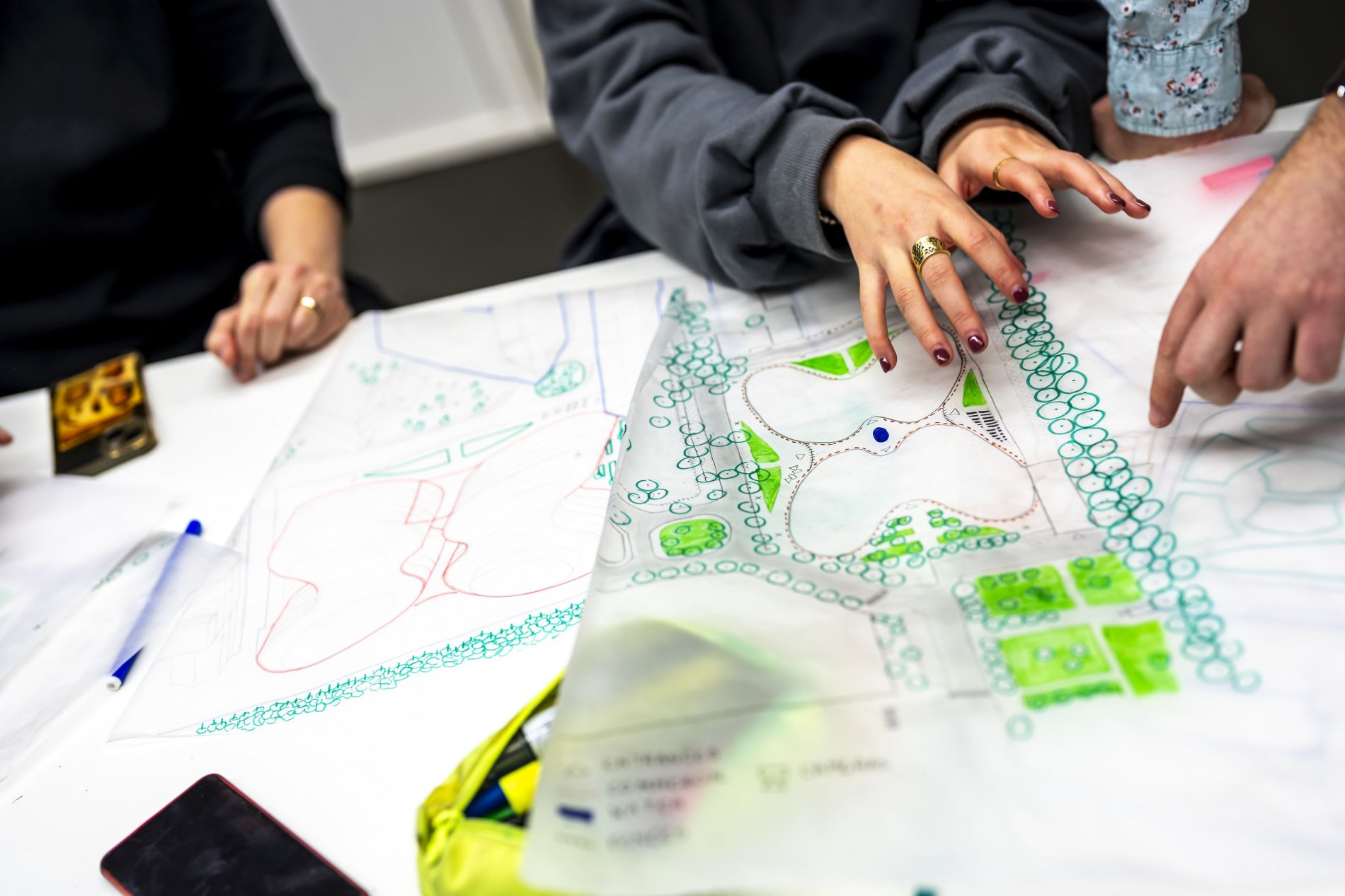
09.00 - 12.00 we meet in front of the Faculty of Architecture, welcome, organisation of students into groups, presentation of the goal of the workshop, key concepts, and methods; each group receives maps, tracing papers, drawing material
13.00 - 16.00 urban safari – site visit
Tuesday
09.00 - 12.00 joint discussion of the urban safari
13.00 - 16.00 groups working on urban analysis, graphical support
Wednesday
09.00 - 12.00 local municipality quest
13.00 - 16.00 groups working on urban analysis and the analysis of the use of the space
Thursday
09.00 - 12.00 groups working on urban analysis and the analysis of the use of the space
13.00 - 16.00 preparation of the presentation
Friday
09.00 - 12.00 group presentations
17.00 - 19.00 gala dinner at CVUT

PRESENTATION
You will present four papers in A2 format on Friday morning. Some guests may join us for the discussion. The presentation should consist of:
Two maps at a scale of 1:10 000 – These maps should illustrate the scale of buildings, the predominant width of their facades, the use of the parterre, public transport stops, parks, and essential amenities such as schools, theatres, and universities that influence the use and character of the space.
Two maps at a scale of 1:2 000 – This scale allows for more detailed representation. You can show materials used, pavement types, the position of CCTV cameras, trees, benches, or water features.
Photographs, diagrams, and texts – Photographs can capture specific user groups present in the space or the traces they leave behind as a footprint of their presence. Diagrams can help visualize the number of people using the space in various contexts.
THE ONLINE PART OF THE COURSE
Students will identify a publicly owned private space in their hometown and assess its attributes compared to a predominant public space in the city.
First, they will present the space's urban history and describe its position within the city's urban network.
Second, they will present the development of public spaces, the land use of the surrounding buildings, and the urban and architectural design, including street furniture, greenery, and water features.
Third, they will analyse how the space is regularly used and describe the formal and informal control over it.
Fourth, the students compare the qualities of the space with the publicly owned urban space.